-------✦ INTRODUCTION ✦------
GLand: GPS Field Area Measure is a powerful tool designed for precise land measurement, making it an essential app for farmers, surveyors, engineers, and anyone who needs accurate area and distance calculations.
Whether measuring land for agricultural use, real estate, or construction, this app provides advanced GPS-based measurement tools that simplify the process.
Users can measure areas and distances with just a few taps, using satellite imagery or on-the-ground tracking.
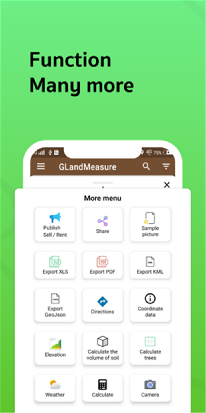
The app supports multiple measurement units and formats, including KML and GeoJSON, ensuring versatility for professional and personal use.
With its easy-to-use interface and real-time GPS tracking, GLand: GPS Field Area Measure delivers efficient and reliable results for all your land measurement needs.
--------✦ KEY FEATURES ✦------
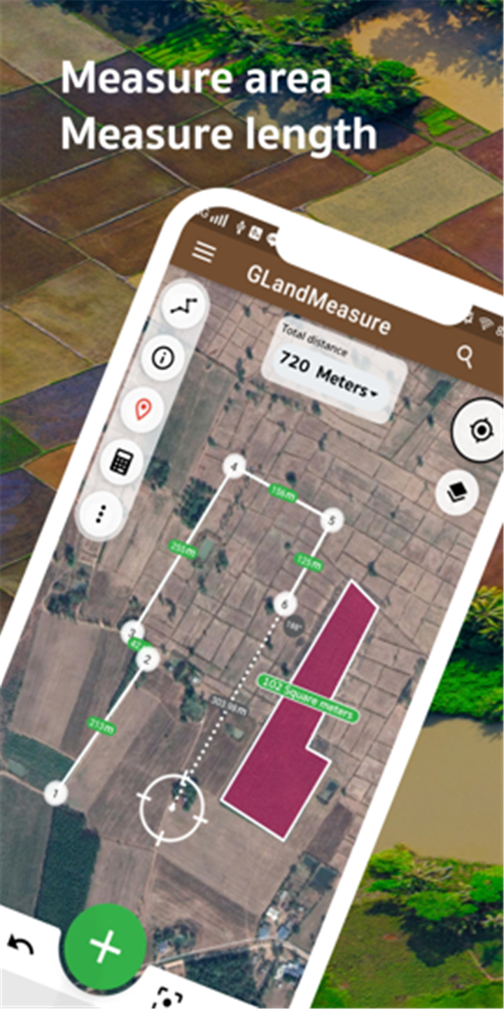
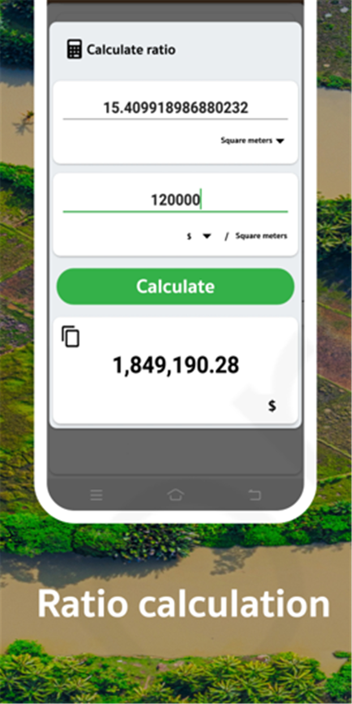
Accurate Area and Distance Measurement:
Calculate land areas and measure distances with GPS-based precision.
Multiple Measurement Modes:
Measure by selecting points on a map, walking around a boundary, or using a built-in camera feature.
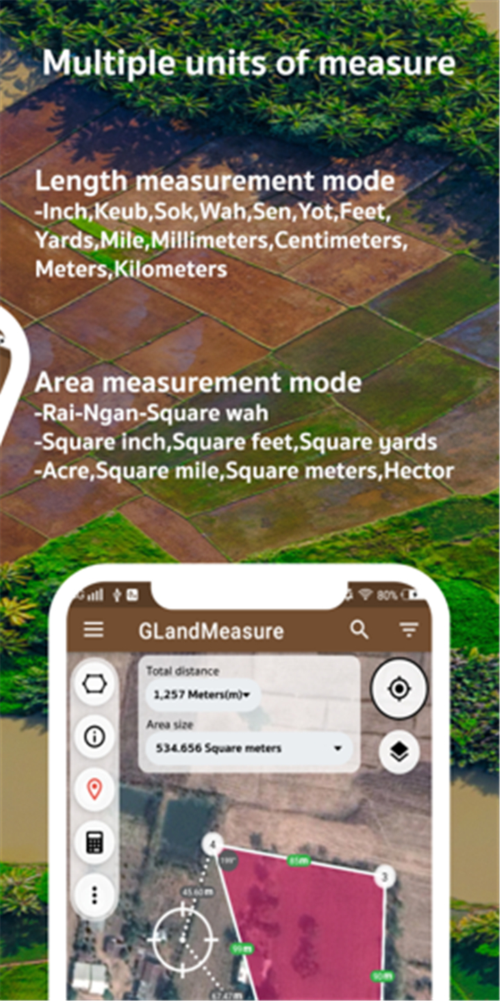
Support for Various Units and Formats:
Export and import data in KML, GeoJSON, and other common formats.
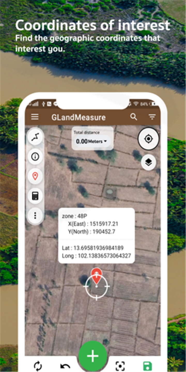
Satellite and Map Integration:
Utilize satellite images and maps for better visualization and accuracy.
Real-Time GPS Tracking:
Measure land while walking for on-the-spot calculations.
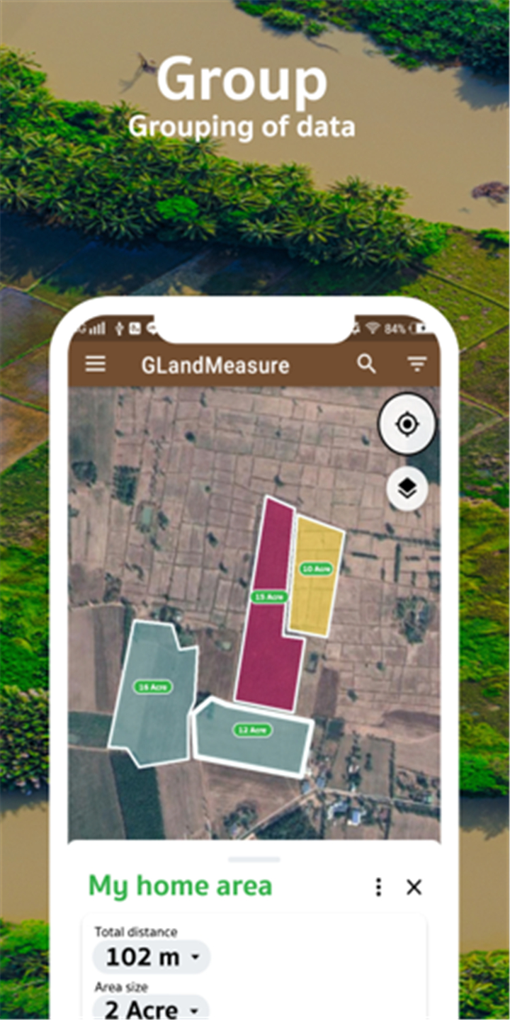
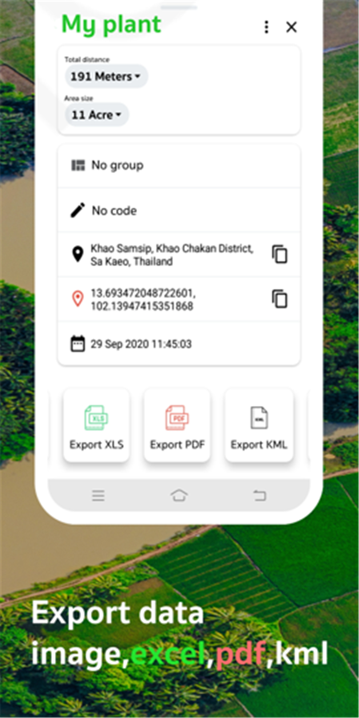
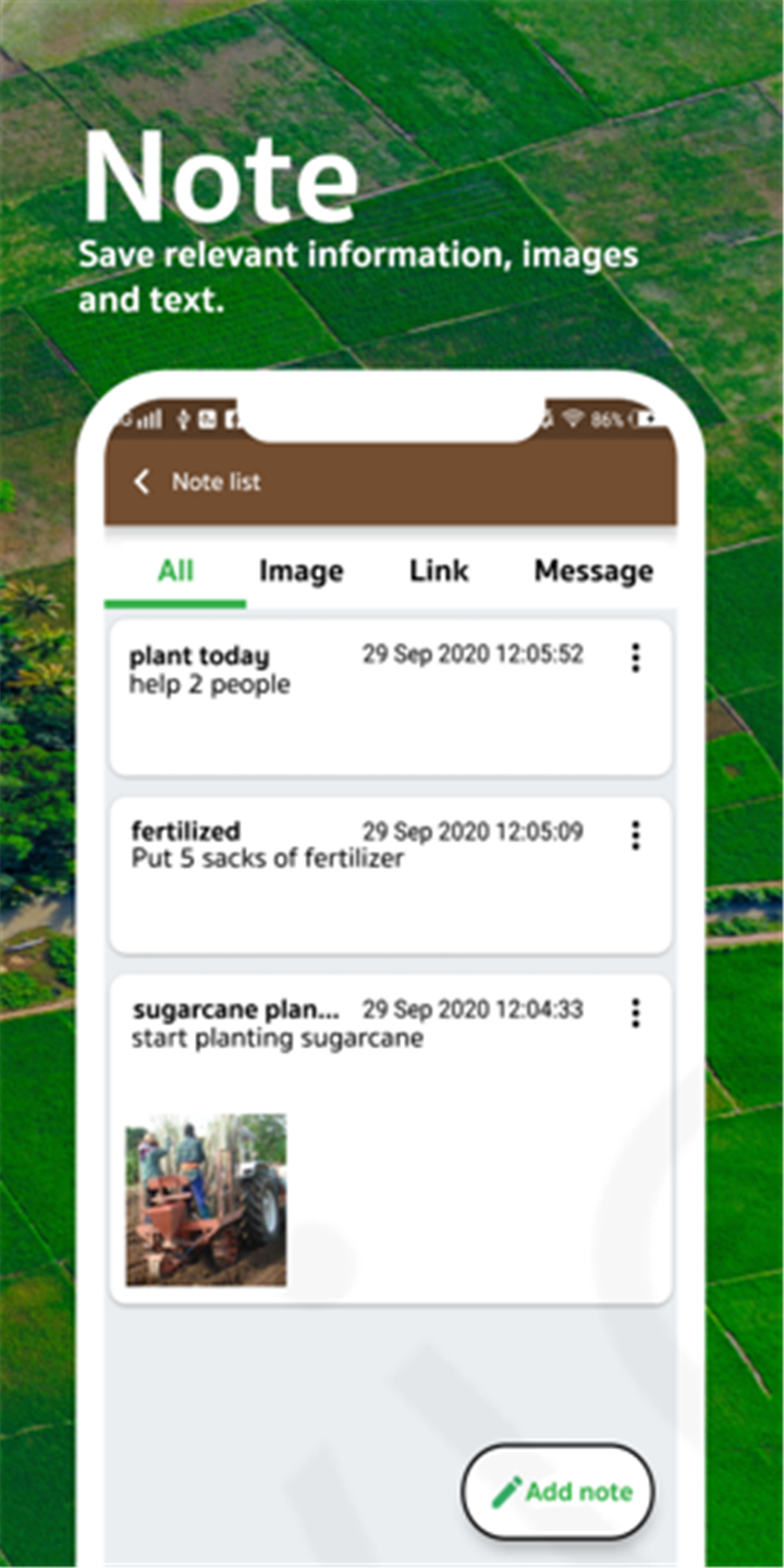
Easy Sharing and Exporting:
Save and share measurements with others via email or file export.
Customizable Settings:
Choose from multiple measurement units and customize the interface for better usability.
GPS Speedometer:
Track movement speed along with distance measurement.
--------✦ COUNTRY OF ORIGIN AND LANGUAGE ✦------
Country: Global
Original Language: English
--------✦ RECOMMENDED AUDIENCES ✦------
This app is perfect for farmers who need to measure farmland, real estate professionals looking for accurate property area calculations, and surveyors conducting land assessments. It is also useful for construction workers, architects, and engineers who require precise land and distance measurements for planning and development. Homeowners and outdoor enthusiasts can also benefit from this app to measure gardens, hiking trails, and other areas effortlessly.
FAQ :
Q: Can I use this app offline?
A: Yes, the app allows you to measure areas and distances offline once maps are preloaded.
Q: What file formats does this app support?
A: The app supports KML and GeoJSON for exporting and importing measurement data.
Q: Is this app suitable for professional use?
A: Yes, the app is designed for professionals in agriculture, surveying, construction, and real estate.
------------------------------------------
Contact us at the following sites if you encounter any issues:
Official website: here
Email: Toptoshirou3@gmail.com
------------------------------------------
Version History
V3.22.0-----26 Mar 2025
Bug fixes and improvements.
- AppSize28.00M
- System Requirements5.0 and up
- Is there a feeFree(In game purchase items)
- AppLanguage English
- Package Namecom.gis.toptoshirou.landmeasure.Glandmeasure
- MD5
- PublisherMaps Tools Utilities Team
- Content RatingTeenDiverse Content Discretion Advised
- Privilege19
-
GLand : GPS Field Area Measure 3.22.0Install
28.00M2025-04-22Updated


7.6
8975 Human Evaluation
- 5 Star
- 4 Star
- 3 Star
- 2 Star
- 1 Star