
-------✦ INTRODUCTION ✦------
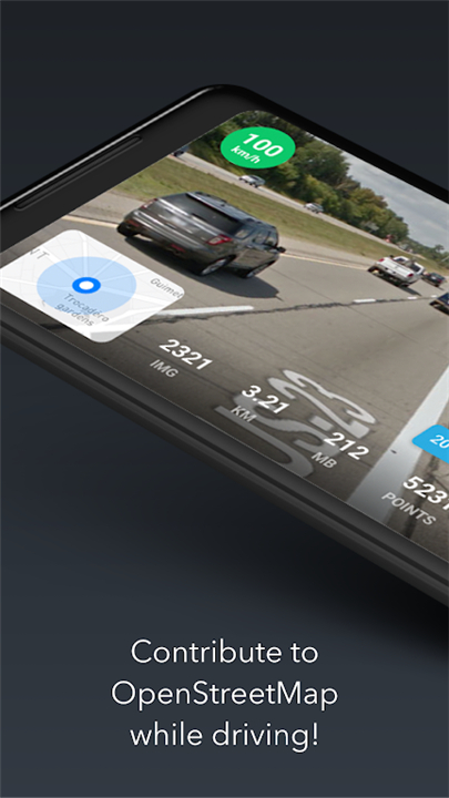
KartaView is an innovative platform that allows users to capture and share street-level imagery using their smartphones.
Designed to be free and open, KartaView empowers anyone to contribute images, making it a valuable resource for enhancing geographic data.
--------✦ KEY FEATURES ✦------
User-Contributed Imagery
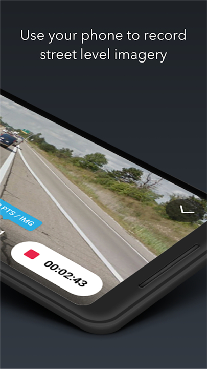
KartaView enables anyone with a smartphone to capture and upload street-level images. This feature encourages community participation and allows users to contribute to a growing repository of geographic data.
Automatic Feature Detection
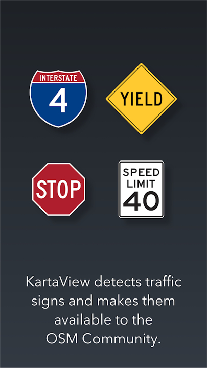
Once images are uploaded, KartaView employs advanced algorithms to detect salient features within the photos. This includes identifying signs, lane markings, and road curvature. This automatic detection streamlines the process of data collection and makes it easier for users to enhance OpenStreetMap with relevant information.
Integration with OpenStreetMap
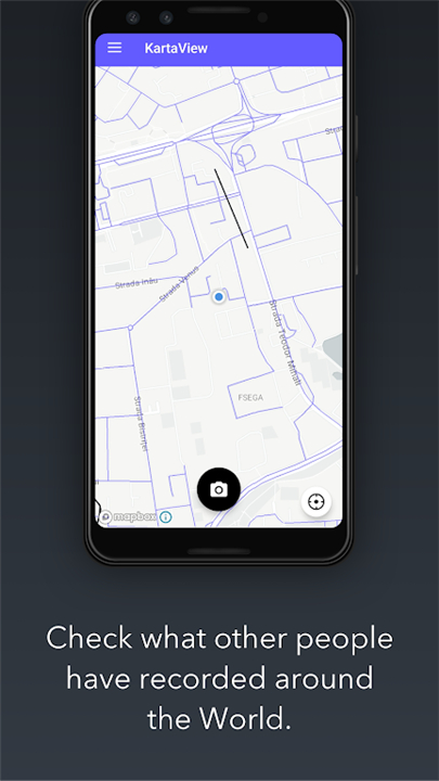
KartaView is designed to work seamlessly with OpenStreetMap, allowing users to leverage the features extracted from their images to improve map accuracy. This integration provides a practical application for the data collected, enabling users to make meaningful contributions to the mapping community.
Open Source and Community-Driven
As an open-source platform, KartaView invites developers and users alike to participate in its evolution. The app encourages collaboration, allowing users to propose improvements, share ideas, and contribute to the ongoing development of the platform.
User-Friendly Interface
KartaView boasts an intuitive interface that makes it easy for users to navigate the app and upload photos. This accessibility ensures that users of all skill levels can participate in contributing to the platform, fostering a diverse community of contributors.
------✦ COUNTRY OF ORIGIN AND LANGUAGE ✦------
Country: United States
Original Language: English
--------✦ RECOMMENDED AUDIENCES ✦----
KartaView is perfect for individuals who are passionate about mapping, geography, and community engagement.
It appeals to a wide range of users, including amateur photographers, urban explorers, and geography enthusiasts who want to contribute to open-source mapping initiatives.
FAQ :
Q: What types of features does KartaView detect from uploaded images?
A: KartaView automatically detects salient features such as signs, lanes, and road curvature from the images you upload, enhancing the data available for mapping.
Q: Can I use KartaView images for other mapping projects?
A: Yes, KartaView encourages the use of its imagery to improve OpenStreetMap and other mapping initiatives, promoting the sharing of geographic data.
Q: Is KartaView available on multiple platforms?
A: Yes, KartaView is designed to be accessible on various devices, allowing users to contribute street-level imagery from their smartphones.
------------------------------------------
Contact us at the following sites if you encounter any issues:
Official website: Here
------------------------------------------
Version History
v6.0.0---- 5 Apr 2025
Various improvements to app stability.
v5.9.6 --- 4 Jun 2025
Various improvements to app stability
v5.9.5 ---- 8 Apr 2024
Various improvements to
app stability
- AppSize49.55M
- System Requirements5.0 and up
- Is there a feeFree(In game purchase items)
- AppLanguage English
- Package Namecom.telenav.streetview
- MD59b75f0d437bac5c3458917ea59beccda
- PublisherGrab Holdings
- Content RatingTeenDiverse Content Discretion Advised
- Privilege19
-
KartaView 5.9.6Install
49.55M2025-04-08Updated


7.3
1962 Human Evaluation
- 5 Star
- 4 Star
- 3 Star
- 2 Star
- 1 Star
![[ROOT] MMRL](https://image.apk52.com/52img/uploadimg/20250408/08164954soez.jpg)