
-------✦ INTRODUCTION ✦------
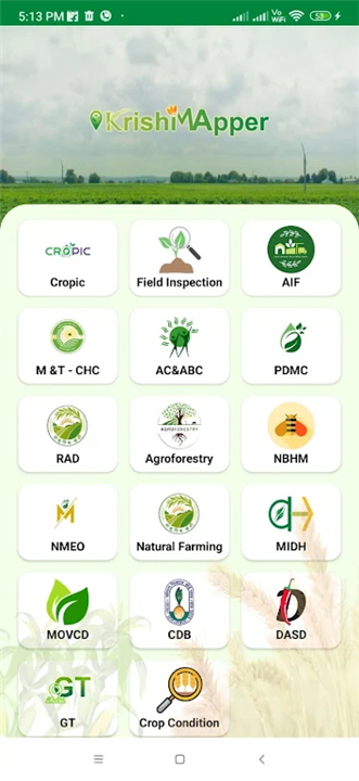
KrishiMapper App is a powerful tool designed to assist in agricultural surveys and land monitoring. Whether you're gathering crop information, measuring land areas, or plotting geo-coordinates, KrishiMapper streamlines the entire process to ensure accuracy and efficiency.
With the ability to capture photos for documentation, the app is perfect for monitoring agricultural schemes and projects.
--------✦ KEY FEATURES ✦------
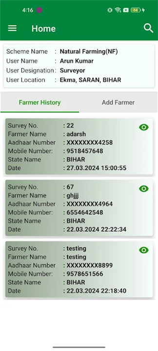
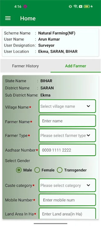
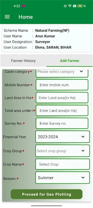
Crop Information SurveysKrishiMapper allows users to collect detailed crop information, including types of crops grown, crop health, and field conditions. This feature ensures that agricultural data is accurate and ready for analysis.
Land Area Measurement
Measure land areas directly from your mobile device. KrishiMapper provides tools to calculate precise measurements for fields and plots, saving time and effort compared to traditional methods.
Geo-Plotting Functionalities
Easily geo-plot land areas and locations with GPS integration. This feature ensures precise mapping of agricultural lands and is essential for documentation and project planning.
Photo Documentation
Capture photos of land areas and attach them to your surveys for visual documentation. This feature is perfect for providing evidence and enhancing the quality of your reports.
--------✦ PHONE REQUIREMENTS ✦------
Operating System: Android 6.0 or laterRAM: Minimum 2GB for smooth functionality
Storage Space: At least 100MB of free space
Internet Connection: Required for syncing data and accessing online features
--------✦ RECOMMENDED AUDIENCES ✦----
KrishiMapper App is an essential tool for professionals and organizations involved in agriculture, land management, and scheme monitoring.
KrishiMapper is the go-to app for anyone seeking efficient, reliable tools for agricultural data collection and monitoring.
FAQ :
Q: What is KrishiMapper used for?
A: KrishiMapper is used to conduct surveys, gather crop and land data, measure land areas, and geo-plot agricultural locations. It is also ideal for monitoring agricultural schemes.
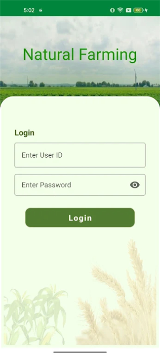
Q: Can I use KrishiMapper offline?
A: Yes, KrishiMapper supports offline data collection, allowing you to work in areas without internet access. You can sync your data once you're back online.
Q: Is the app suitable for government projects?
A: Absolutely! KrishiMapper is perfect for government agencies monitoring agricultural schemes and collecting data for reporting purposes.
Q: Does the app allow photo documentation?
A: Yes, KrishiMapper lets you capture and attach photos of land areas to your surveys for visual documentation.
------------------------------------------
Contact us at the following sites if you encounter any issues:
Official Website: Here
------------------------------------------
Update
Feb 10, 2025
- AppSize26.00M
- System Requirements5.0 and up
- Is there a feeFree(In game purchase items)
- AppLanguage English
- Package Namecom.agri.krishimapper
- MD5
- PublisherMINISTRY OF AGRICULTURE
- Content RatingTeenDiverse Content Discretion Advised
- Privilege19

-
KrishiMapper 2.9Install
26.00M2025-04-22Updated


8.2
4939 Human Evaluation
- 5 Star
- 4 Star
- 3 Star
- 2 Star
- 1 Star